.jpg)
The rule that turns an ice sheet into a desert
The assumption behind most people's first guess, that a desert needs sand dunes and blistering heat, isn't how climatologists actually define the term. The U.S. Geological Survey classifies deserts by precipitation alone: any region that averages less than 250 millimeters (10 inches) of rain or snow a year, and typically loses more water to evaporation than it gains from what falls, counts as a desert regardless of temperature. National Geographic Education's own materials make the same point directly, framing it as a corrective to the sand-and-heat assumption: not all deserts are sandy, and several of the driest places on the planet are covered in ice rather than dunes.
Antarctica clears that bar with room to spare. Coastal areas of the continent average a bit over 200 millimeters (8 inches) of precipitation a year, already close to the desert threshold, but the vast interior receives far less, in places only a few millimeters of snow-equivalent moisture annually, drier than large stretches of the Sahara. What keeps Antarctica buried under an ice sheet up to several kilometers thick despite that scarcity is retention: nearly all of the small amount of snow that does fall there stays put, accumulating and compressing over hundreds of thousands of years without ever fully melting or sublimating away.
Where the real ranking lands
Once the precipitation-based definition is applied consistently, the standings look nothing like the popular guess. Antarctica leads at roughly 14.2 million square kilometers (5.5 million square miles). The Arctic desert, the sea ice, tundra, and polar barren ground spanning northern Greenland, the Canadian Arctic Archipelago, and Arctic Russia, comes in second at close to 13.9 million square kilometers, though because its boundary is drawn less consistently across sources than Antarctica's coastline, other tallies place it slightly lower, around 13.7 million. Either figure keeps it well ahead of the Sahara, which covers about 9.2 million square kilometers (3.6 million square miles) and is the largest hot desert, not the largest desert outright, a distinction that gets dropped constantly in casual usage. Fourth place goes to the Arabian Desert at roughly 2.33 million square kilometers, the largest desert in Asia and the biggest of the remaining subtropical deserts once the two polar giants and the Sahara are accounted for.
The gap between the top four and everything beneath them is enormous. The Gobi, spanning Mongolia and northern China, covers around 1.295 million square kilometers, less than a tenth of Antarctica's total, and it is commonly cited as the sixth-largest desert once the Patagonian Desert is slotted in above it. Below that, rankings start to blur, because the sources doing the measuring stop agreeing on what to measure in the first place, not because the deserts themselves are especially hard to survey.
Why 'largest desert' rankings don't agree with each other
The Kalahari is the clearest example of how a single desert can generate two wildly different area figures depending on which boundary a source is using. The Kalahari Desert proper, the semi-arid, sand-covered basin spanning Botswana, Namibia, and South Africa, covers about 900,000 square kilometers (350,000 square miles). But a second, larger term, the Kalahari Basin, describes the broader geological and hydrological depression the desert sits inside, and that figure varies enormously depending on where a source draws its edge, from roughly 725,000 square kilometers under a narrower geological definition up to figures exceeding 2.5 million square kilometers when the basin's full drainage extent, reaching into Angola, Zambia, and Zimbabwe, is counted. A list that quietly uses the basin figure instead of the desert figure will report the Kalahari as bigger than the Sahara; a list that uses the narrower desert figure won't come close.
Polar deserts create a second, more consequential version of the same problem. Because Antarctica and the Arctic don't look like deserts to most readers, many popular "world's largest deserts" lists quietly exclude them from the ranking entirely, or bury a footnote about the technicality partway down the page, and then present the Sahara as the outright winner without ever stating that the list has been filtered to exclude ice. That filtering choice, not a disagreement over Antarctica's actual area, is the real reason the Sahara still gets called "the world's largest desert" in casual conversation far more often than Antarctica does, even though the precipitation-based definition every major source agrees to use puts Antarctica well ahead. Rainfall rankings run into a related kind of category confusion: there is no single "wettest place on Earth" either, because the World Meteorological Organization tracks sustained multi-decade averages and single extreme events as separate records that different villages hold outright, rather than ranking every location on one combined scale.
The desert inside the desert: Antarctica's ice-free valleys
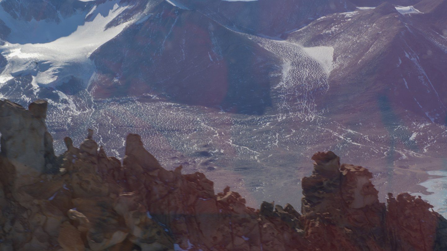
Antarctica contains a desert within its desert. The McMurdo Dry Valleys, a cluster of valleys in Victoria Land near McMurdo Sound, cover about 4,800 square kilometers and form the largest ice-free region on the entire continent, a landscape of bare rock, gravel, and wind-carved ridges like the one pictured above, a stark break from the ice sheet that covers nearly everything around it. The Transantarctic Mountains block moist air from reaching the valleys, and katabatic winds, dense, extremely cold air draining downhill off the polar plateau, sweep whatever moisture does arrive back out and evaporate any snow that briefly settles, the same evaporation-before-landing effect that produces virga over hot deserts elsewhere on the planet.
Cosmogenic exposure dating, developed by geologists David Sugden and George Denton and refined by later research teams, measures how long a rock surface has sat exposed to cosmic radiation, and the results place the Dry Valleys among the most stable landscapes on Earth: at high elevations above roughly 1,000 meters, a cold, dry polar climate appears to have persisted largely unchanged for about 12 million years, with individual peaks like Mount Fleming and Mount Feather returning exposure ages in the 5-to-10-million-year range. That extreme stability, combined with the cold and near-total absence of liquid water, is why NASA has used the Dry Valleys as a research analog for Mars, studying the microbial life that researchers have found surviving in the valley soils and beneath the ice covering some of its permanently frozen lakes to understand how life might persist in equally hostile conditions on another planet.